Sectors and Areas of Experience
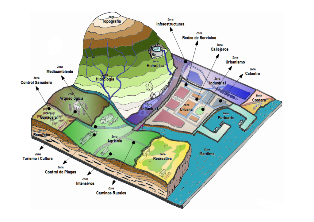
- Engineering, Architecture and Urbanism, Applied to the management of the territory and resources.
- Aerial, satellite, lidar images and spatial data processing.
- Comprehensive operation of flight equipment (manned and unmanned aircraft) in any scenario and climate, for digital mapping missions and aerial supervision of natural resources, infrastructure, and transportation.
- Topography and digital cartography.
- Geolocation.
- Large-scale field work for censuses, inventories (of infrastructures and resources), regulatory surveillance of urban and rural territory.
- Management and Sustainability of natural resources, precision agriculture, livestock, fishing, forestry, …
- Legal and Economic Management of the Territory: Cadastre, Property Registry and Taxation of the territory.
- IT and communications solutions for Digital Administration.
Engineering, Architecture and Urbanism, Applied to the management of the territory and resources
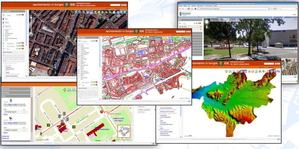
Tools and information systems to organize and manage the different areas of the Public Administrations responsible for the management and evolution of the territory:
- Cartography and urban planimetry
- Road plans, plots and boundaries
- Access (public and restricted) to urban planning information on “general plans”, “special plans” and “sector plans”, linking planimetric and cartographic information to urban legislation and regulations
- Processing of project licenses, construction, work, occupation, etc…, integrating the applications in the circuits of the digital administration and linked to the databases of territorial objects
- Digital management of “as built” documentation integrated with cartography and databases and images, with maintenance of historical series
- Applications for the collection of fees, public prices and rights
Aerial, satellite, lidar images and spatial data processing
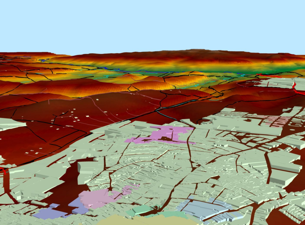
Aerospace, computer and communications technology focused on:
- obtaining
- treatment
- advanced interpretation
- aerial and satellite images
Specification and Processing:
- Specification of the type of images and choice of the means of acquisition in each project, case and sector: satellite, manned aircraft or UAV (drones).
- Digital processing of images to the appropriate formats for each project
- Interpretation of digital images based on robotic artificial vision techniques and assisted by human operators, to obtain spatial models, cartographies, biomass characterization, identification of polygons, plots, riverbeds and wetlands, communication routes, power lines and other infrastructures.
- Indexing of images with the common databases of the project or system.
Satellite:
- Choice of medium, definition of required parameters and acquisition and treatment planning.
- Selection (among the different available satellite operators), management, and purchase negotiation of the collections of images and required metadata
Aerial:
- Determination of characteristics: spectral range (visible, RGB, UV, IR, multispectral, hyperspectral…), resolution, etc.
- Use of Lidar (Laser Imaging Detection and Ranging), according to terrain profile, infrastructure elevation, vegetation and other requirements.
- Flight planning.
- Operation of flight equipment.
Topography and digital cartography
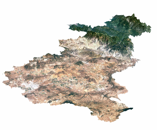
The objective of cartography is the study and elaboration of maps that serve for navigation and the location of things.
Digital mapping, using geographic information systems, encodes and manages variables and geospatial data. For this, different resources are used, such as georeferenced databases, computer-aided design programs, automated cartography and remote sensing.
Digital topography and cartography allow the modeling of the physical world. The scope of modeling is very wide, going through mountains and rivers, to streets, buildings, cables and pipes of public services and other resources. The final utilities are as extensive as reality itself, any element that can be located in the territory has its place.
The territory represented by these systems can be displayed on maps with the help of geographic information systems that store, manipulate and display the referenced geographic data.
The resulting information layers are the essential work base for any management system related to any activity carried out on the territory.
Comprehensive operation of flight equipment
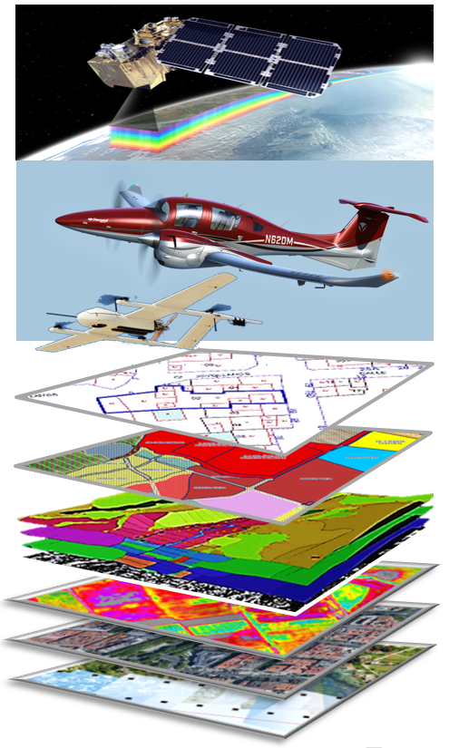
Long-haul, high-speed, multi-mission manned aircraft
Equipped with multiple sensors (cameras, lidar, radar, etc.) capable of flying in any scenario and climate, even in adverse weather conditions to guarantee the safety of the mission overpopulated areas.
Unmanned aircraft
Autonomous drones in general, with supervised, assisted or remote piloting for specific inspection missions:
UAV-VTOL: autonomous fixed-wing aircraft, with medium speeds and short-medium range, with a high glide ratio and fully vertical landing and takeoff capability, for planned multispectral and lidar photography missions.
Multi-rotor UAV: medium-low speeds and short-range precision hovering and very low speed flight, for supervised autonomous missions or with remote piloting of parcel mapping, detailed inspection of infrastructures, precision agriculture, emergencies and other missions.
- Digital mapping missions and monitoring of natural resources
- Inventories of public infrastructure and service networks
- Predictive maintenance of public infrastructure and service networks (electricity, water, roads, river traffic, etc.)
- Surveillance of urban compliance and industrial, economic, extractive activities (forestry, mining, fishing quotas, etc.) or modifiers of the territory
- Special surveillance and supervision missions of the territory
- Interpretation, reporting and maintenance of databases and images
- 100% autonomous mission planning, overflight exclusion sectors and other parameters.
- General flight planning: Meteorology, routes, overlaps, altitude above ground, flight altitude, speed, landing and take-off bases, schedules, logistics, security restrictions, authorizations, preparation and processing of the flight plan, etc.
Safety in overflight areas and for air traffic. ADS-B equipment
All our teams fly equipped with ADS-B transceivers, from the Dependent Automatic Surveillance – Broadcast system.
It is a system that actively transmits information about an aircraft, such as its position, determined via satellite, its altitude, speed, heading, vertical speed, aircraft identification, etc.
ADS-B allows identification by other aircraft and tracking by Air Traffic Control Authorities.
ADS-B is the standard adopted by the Agency for the Safety of Air Navigation in Africa.
Geolocation: Geographic Information Systems and Spatial Data Infrastructures
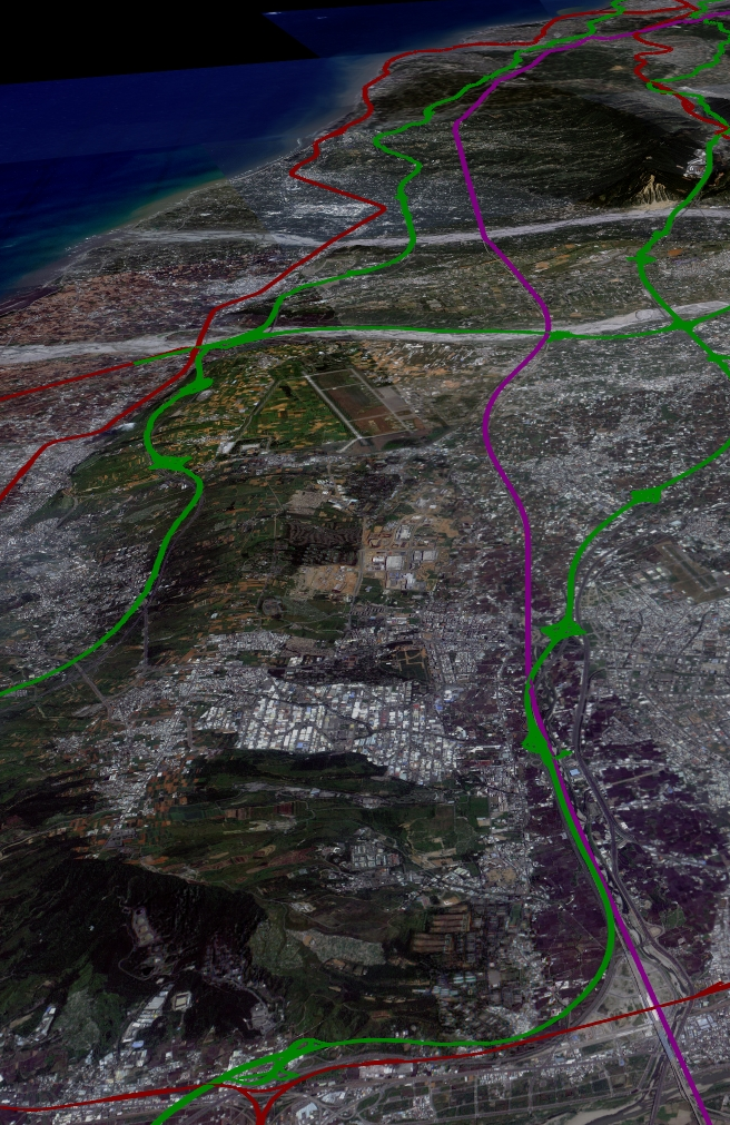
Geographic Information Systems (GIS) and Spatial Data Infrastructures (IDE) are the basic tools for handling and managing Geolocated data.
One of the basic components that characterize any human activity is the location where it occurs. Location of both the activity and the “inputs” and “outputs” that make it up.
Through the advanced use of GIS and IDE tools we can develop corporate information systems for the management, from the local to the national level, of all kinds of areas.
- Cadastral Systems: everything related to the ownership of urban and rural land. Identification of properties, characterization, appraisal, etc.
- Property Registry: Digital registry integrated with the Cadastre and other functions of the Digital Administration.
- Urban Planning and Development Systems: Management of urban regulations, urbanization and building projects, building permits, urban discipline, etc.
- Inventories of Infrastructure and Public Property: urban endowment, roads, supply networks, transport systems, ….
- Electric transmission and distribution networks: Dynamic inventories of network elements, monitoring and predictive and reactive maintenance (HV and MV transmission networks).
- Drinking water and sanitation networks, “integral water cycle”: Inventory, Monitoring, Smart Network Management.
- Highways, highways, roads, bridges, freight traffic and river traffic: infrastructure inventory, predictive maintenance, capacity control systems and weighing control, load tracking.
- Agriculture, livestock and food safety: Management and planning of agriculture, livestock and forestry, Logistics, Smart production management, Crop collection logistics management systems, Drone operation, image and data processing, Traceability.
Fieldworks
Large-scale campaigns for censuses, inventories and surveillance of urban and rural territory.
- Censuses and inventories of biomass, resources, infrastructure, property, human and economic activity in the territory
- Data collection and appraisals for Property Registry and Cadastre
- Urban, transport and environmental surveillance with aerial means and monitoring technologies through way stations or satellite
Management and Sustainability of natural resources
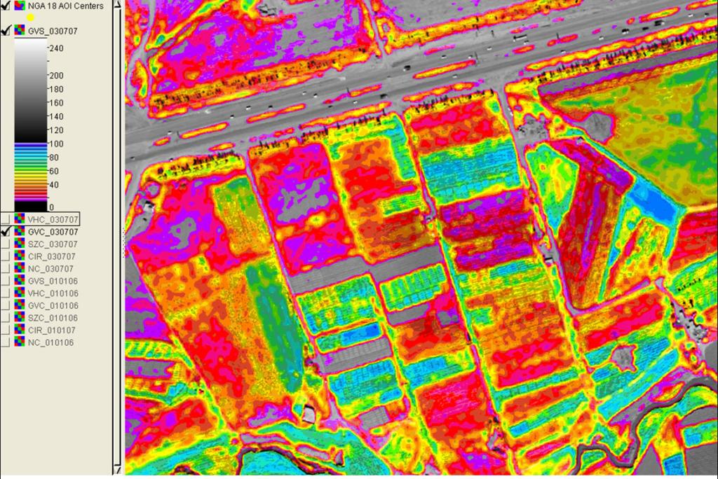
- Precision agriculture: drone management for crop maturation and optimization, pest surveillance and control, irrigation and fertilizer planning according to the desired maturation, logistics management planning and control, traceability, etc.
- National, regional and collaborative meteorological networks (integration of users’ micro meteorological stations in the global network).
- Livestock: management of pastures and other crops for animal feed, monitoring of herds in freedom or semi-freedom, comprehensive traceability, etc.
- Fishing: evaluation of biodiversity, movement of plankton, banks and schools, surveillance of catch quotas, traceability from the origin of the catch, processing and destination in the final market, etc.
- Food safety: Integrated chain planning and supervision systems
- Forest exploitation: censuses of gross forest biomass, identification of species of commercial interest and protected, certification systems of origin (including genetic fingerprint), supervision of exploitation and logging agreements, traceability, evolution of forest density and mass, conditions bioclimatic…
- Conservation of the natural environment: Biomass, biodiversity and nature reserves
- Water resources: river courses, gauging of riverbed wells, dams and wells, rainfall, control of underground aquifers and abduction catchments, humidity of farmland, monitoring of wetlands and flood zones, etc.
- Energy: Censuses and supervision of renewable energy production systems, safety inspections and predictive maintenance, productivity evaluation, etc.
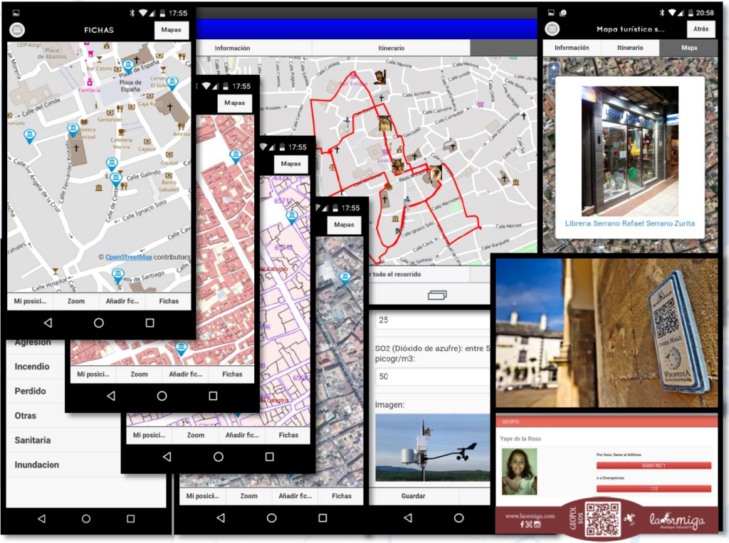
- Tourism: Visitor assistance through information and security applications (APPs), routes, inventories of tangible and intangible tourist resources, traceability, etc.
Legal and Economic Management of the Territory
IT and communications solutions for Digital Administration

Focused on the development, evolutionary maintenance and operation of systems capable of integrating land management, always updated, accessible to public administrations, professional users and the general population.
Legal certainty, transparency in management and compliance with processing times and processes oblige Public Administrations to join the “Digital Public Administration”.
Systems prepared for telematic management, which allow citizens to interact with all levels of public administration, imply a change both in the systems themselves and in communications.
The automation of processes and the publicity of all administrative procedures represent a change, not only technological, but also in the procedures and in the ways of approaching the public function.
The accreditation of the identity of the intervening parties requires certification systems from public administrations, both for citizens and public agents. It must guarantee not only its capacity to act but also its authority to decide. Certifications based on public and private keys are the usual guarantee tool in this type of system.
The Digital Public Administration, beyond a reality demanded by citizens towards public managers, is an essential tool of transparency required in relations with international organizations as a way of accrediting compliance with the agreed purposes.
