Products and Services
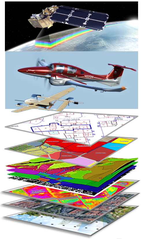
Technologies for Territory Management and human activity on it.
- Acquisition and processing of aerial and satellite images and advanced processing.
- Planimetry and Digital Cartography.
- Cadastre, Property Registry, Tax and Fee Management.
Development and Implementation of Applications and Information Systems and Territorial Management
- Urbanism, Public Works, Property Registry, Multipurpose Cadastre and Taxation of the Public Treasury
- Electric transmission and distribution networks
- Drinking water and sanitation networks, “integral water cycle”
- Roads, highways, roads, bridges, freight traffic and river traffic
- Agriculture, livestock and food security.
Management of population groups, activities or services (health, employment, mutual, insurance, cooperatives, etc.)
- Social Security and public, private, mutual and concerted health insurance
- Employment protection, accident and unemployment mutual fund
- Public services and with Social Protection NGOs
Business Intelligence and Big Data Systems
Telework, distributed access and virtualization of information systems
Digital Public Administration and Digital Society
Technologies for Territory Management and human activity on it
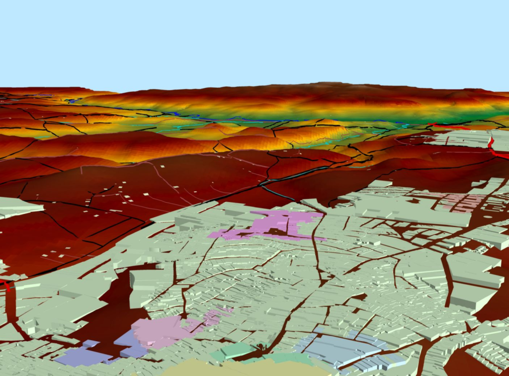
Acquisition and processing of aerial, satellite and advanced processing images.
- Multispectral satellite images
- Aerial images with manned and/or autonomous UAV and UAV-VTOL (short, medium and long range), multispectral, hyperspectral and LIDAR flights.
- Treatment and generation of orthophotos.
- Spatial restitution in 3D (land elevation and infrastructures).
- Intelligent-assisted analysis of polygons, land, infrastructure, buildings, crops, water reserves, reserves and evolution of agricultural and forestry biomass, geological and edaphological data (according to multispectral patterns), human activity, energy emissions, etc.
Planimetry and digital cartography
- Integrated with other tools for urban planning and territorial and tax management.
Cadastre, Land Registry, Censuses, Management of Taxes and Fees
- About the Territory and human activities in the Territory (agriculture, livestock, forestry, transportation, industry, commerce, tourism, etc.), integrating them to coherently manage services, investments in infrastructure, rates, taxes, concessions and other public resources.
Development and Implementation of Applications and Information Systems and Territorial Management
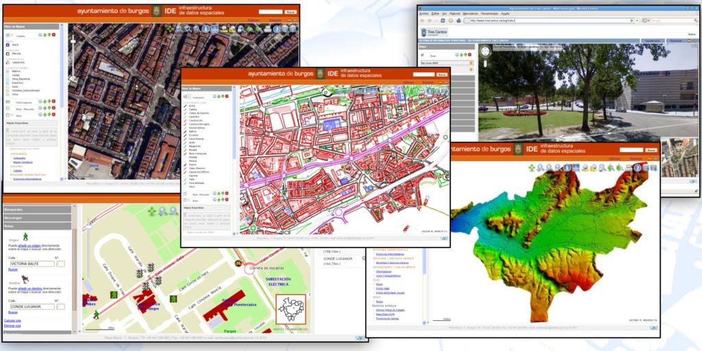
Urbanism, Public Works, Property Registry, Multipurpose Cadastre and Taxation of the Public Treasury.
Infrastructure and Public Property Inventories
Urban endowment, roads, supply networks, transport systems, ….
Multipurpose Cadastre Systems (Urban and Rural)
Identification of properties, characterization, appraisal, etc.
Property registration
Digital registry integrated with the Cadastre and other functions of the Digital Administration. Coherence, legal certainty, equity in the payment of taxes on the territory, property ownership, localized economic activities, concessions, rates and public prices for payment of services…
Urban Planning and Development Systems
Management of urban regulations, urbanization and building projects, building permits, urban discipline, etc.
Smart City
Electric transmission and distribution networks
Dynamic inventories of network elements
Transportation, distribution, stations, substations, consumption points and customer access.
Predictive and reactive monitoring and maintenance (HV and MV transport networks)
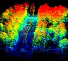
Integrating fixed and aerial thermographic and multispectral images from UAV-VTOL drones with “historical behavior patterns”, for the predictive management of failures, cleanliness, wear and corrosion of cables, insulators, anchors, anti-resonance vibration nodes, stations and substations, evolution of cleanliness, vegetation, fire risk and maintenance of physical accessibility in corridors clear of transmission lines, etc.).
Drinking water and sanitation networks, “integral water cycle”
Inventory
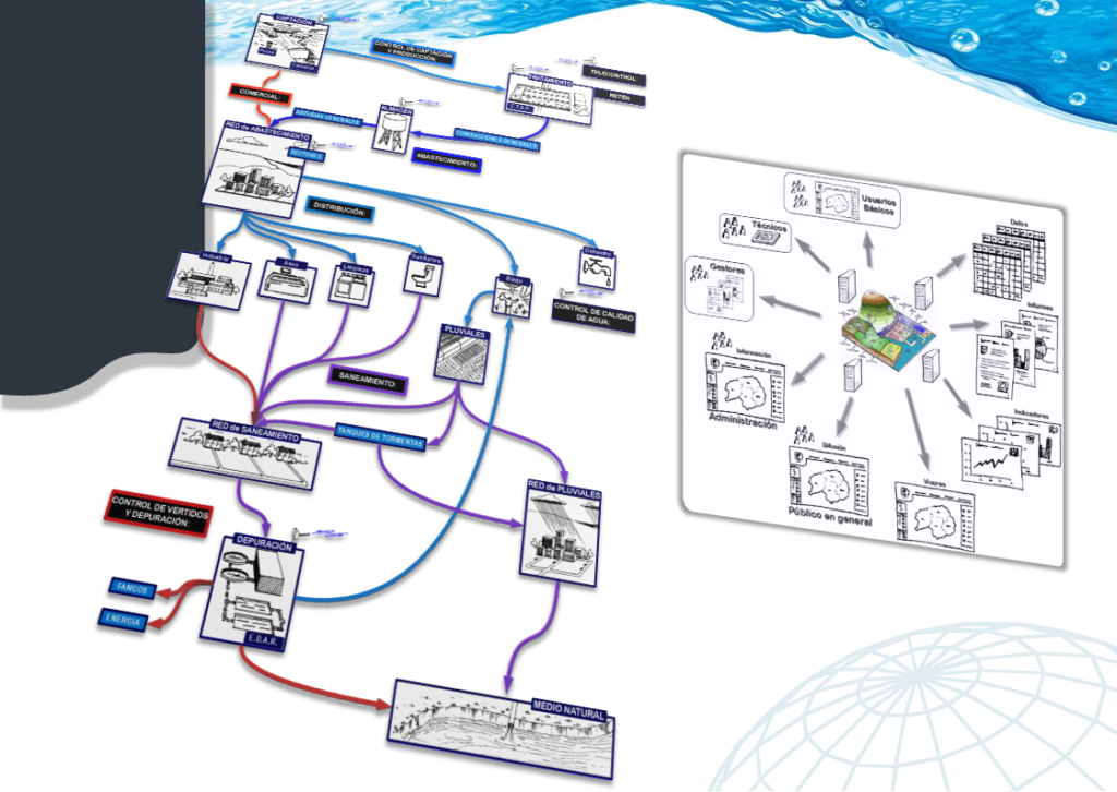
Urban distribution and sanitation networks, from the DWTP to the point of consumption, integration of data from network sensors and consumption meters, sewage network, collectors, etc., to the WWTP and restitution to the natural environment (channels, sea, u other discharges).
Monitoring
Gauges and reserves, wells and effluents, abduction, transportation, ETAP water treatment plants, distribution and sanitation networks, WWTP wastewater plants, discharge quality control.
Smart network management
Outages, breakdowns, extensions, prediction of future demand associated with population growth, urban development and habits. Integration with urban planning tools.
Semi-automated and intelligent network planning tools
Integrating the design of expansion projects, reorganization and new connections with calculations of network components, flows, pressures, etc., work orders and updating of “as built” documentation in real time
Roads, highways, roads, bridges, freight traffic and river traffic.
Infrastructure inventory
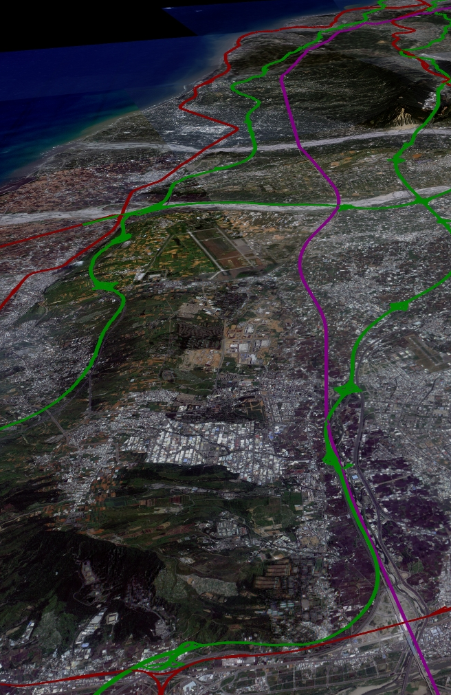
Integration of inventories of civil works, infrastructure, signaling, communications and others deployed in the road network, including project and maintenance documentation, traffic demand planning, etc.
Predictive Maintenance
through the acquisition and treatment of periodic multispectral images of the road surface and the surrounding vegetation.
Capacity control and weighing control systems (ports, customs…).
Cargo tracking
Vehicles, containers, barges, forestry and agricultural loads, etc., by means of fixed and mobile systems on the circulation route and/or accesses or control points (ports, customs, free zones, tolls, etc.), integrating:
- Identification by images of the vehicle license plate, container license plate or visible label (logo, QR Code; ISO 128, GS1, EAN 8 and EAN 13 barcodes).
- Marking and “traceability” with RFID tags (active or passive), GPS, satellite, etc.
- Weighing by weight sensors per axle and speed; both static and dynamic at low speed at checkpoints and dynamic at high speed on the track itself (without stopping).
- Integration of gauging, traffic, identification, weighing and traceability (transit, security, customs control, etc.).
Agriculture, livestock and food safety
Management and planning of agriculture, livestock and forestry.
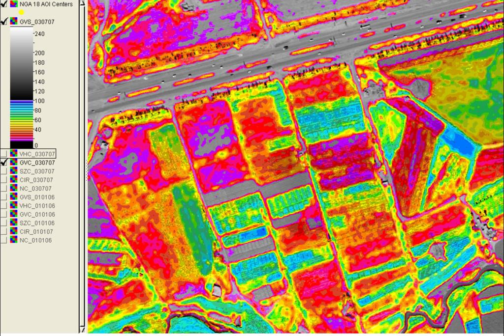
Identification and characterization of land, species, wetlands, crops, etc., allocation and supervision of uses, monitoring of historical data series and progressive exploitation of predictive systems.
Logistics
Collection of products, integrated with value-added processing companies (preserves, juices, concentrates, etc.),
Smart production management
Monitoring of regional climate and microclimates, irrigation, maturation, pests, placing on the market, matching and prediction of consumption, evolution of demand and prices… linked to the programming of maturation and harvesting of crops and logistics…, etc., with DB systems , BI and AI.
Crop harvest logistics management systems
Virtual chamber for “supply-demand matching” and “payment compensation” to farmers, fertilizer planning, phytosanitary products, irrigation, harvesting, insurance, etc.).
Drone operation, image and data processing
Historical and relational databases for precision agriculture, livestock, aquaculture, fishing, forestry and sustainable exploitation of all kinds of resources.
Traceability
Origin and transit certification systems for food and forestry production. In accordance with mandatory international standards for international trade and imports from certain countries (mainly USA, EU27 (Europe), UK (United Kingdom), Russia & CIS, Japan, etc.).
Management of population groups, activities or services (health, employment, mutual, insurance, cooperatives, etc.)
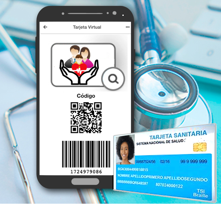
Comprehensive systems based on “physical and virtual cards”
Accreditation of personal identity and processing of information via any communications device, mobile phones, computers, etc. for example:
“Health card” and “Social protection system card”.
Design, supply and operation of integrated pension and social security systems, mutual and cooperative insurance.
Information, Technology and Communications Systems Insurance Companies
Health (private and concerted)
accidents; Prevention and Safety at Work and Occupational Health (mutual employers, cooperatives, groups, private and public-private entities, etc.)
Telemedicine and Assisted Remote Diagnosis Systems
Agriculture Insurance
Other sectors such as construction works, machinery, automobiles, civil liability, etc.
Identity accreditation and geolocation systems
Physical and/or virtual cards through secure APPs on mobile devices, with secure access to selective databases in real time (health, epidemiology, vaccinations, education, security, productivity, transport, machinery, goods, etc.).
Online accessibility
Authentication of users and service providers and transaction management, especially oriented to Digital Administration.
Business Intelligence, Big Data
Concepts such as Business Intelligence, Big-data, Learning-machine, Artificial Intelligence…, have become a recurring need, which requires a detailed analysis of the objectives to be achieved, as well as special care in that the “solutions”, Basic “applications”, “systems” and “applications” are designed and implemented open to these options from the outset, whether they are a present need or not, since some of them will undoubtedly have to be considered in the near future, if due to limitations of budgets, analysis of objectives or terms of operation are not implanted from the outset.
These methodologies and technologies are applied in successive “layers” of system and subsystem integration, both GeoThea’s own and those of third parties that have open data exchange formats.
The open architectures of each system and platform must, therefore, ensure the integration, evolution, interconnection and interoperability of the whole (initial or future), this responsibility corresponding to both the designer and supplier and the contracting administrations.
GeoThea, and its technology partners (TEC partners) express their firm commitment not to mortgage future developments, proposing, designing and implementing Optimized Systems for Digital Administration.
These capabilities mean taking a qualitative leap in knowledge and improvement in all areas of administration (Public Administrations or private companies), in such a way that global and sectoral decision-making is optimized at all levels.
This qualitative leap allows us to go from “having a lot of data” to “having real knowledge, knowing what is happening at all times, anticipating what may happen with accurate decisions, knowing where it is efficient and where it is not”.
Telework, distributed access and virtualization of information systems
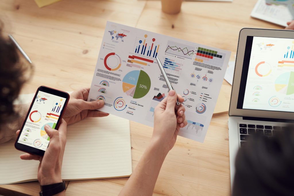
It has been shown as a strategic need to have the capacity to relocate the physical presence of workers, customers, suppliers, officials and administrators (population).
To this end, GeoThea has committed to this challenge, updating all its existing applications and designing all its future applications, in such a way that they allow:
- Secure remote access.
- Multi-device access, through interfaces that virtualize any standardized commercial device and all our applications, constituting an open and secure environment.
- Integration of data and access to systems (of the public, professional groups, public administration departments, etc.) to multiple applications that use interrelated data.
- Maintenance of the coherence and integrity of the same data, always updated to the modified one from different sources of accredited access to the integrated system.
All this implies a drastic cost reduction, reliability, the practical elimination of coherence errors, efficiency, sustainability and improvement of management and image.
They are solutions of very high visibility for the population and also for international “observers” of the evolution of the Public Administration, civil society and the country’s business environment.
Digital Public Administration and Digital Society
Legal security, transparency in management, and compliance with processing times and procedures require all government entities to lead the “Digital Public Administration” and make it easily accessible.
Systems with multichannel access that facilitate citizen interaction with all levels of the Public Administration involve implementing and maintaining flexible operating procedures and technological models that seamlessly integrate any new communication technology and the mobility habits and usage of the population.
The automation of processes and public access to all administrative procedures and information involves promoting permanent change, not only technological but also in procedures and ways of approaching public service and citizen communication.
Geothea focuses its solutions on the following areas:
- Territory Management, Cadastre, Property registration, associated taxes, and public service supply networks.
- Management of Public Social Security Systems, pension, and health insurance.
The verification of the identities of those involved (citizens, general public, officials and other collaborators of the system) requires public administrations to have certification systems for both citizens and public agents. It is not only necessary to ensure their ability to act, but also their authority to arbitrate or decide.
The use of Public Key and Private Key certifications (whether based on blockchain or centralized authority) is the usual guarantee tool in this type of system.
The Digital Public Administration, beyond a reality demanded by citizens to public managers, is an essential tool for transparency required in relations with international organizations as a way of accrediting the institutional commitments of the state.
